
GPS spoofing and the return of real navigation

FirstBeat - Offshore racing intelligence -talking technology
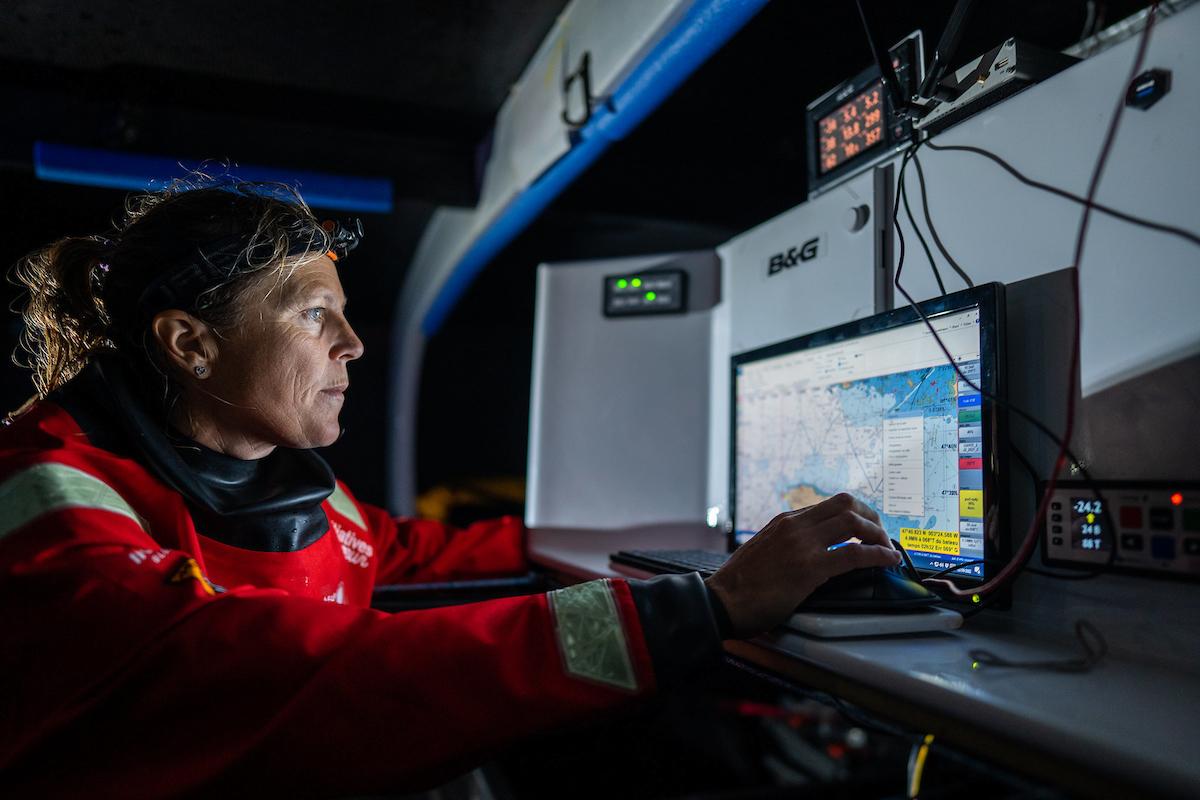
GPS is probably the most useful navigation tool ever put on a race boat, and that is not the problem. The problem is that it is so good, so cheap, so accurate and so invisible in the background that it has quietly removed something every serious navigator used to have drilled into them, which is the habit of mistrust. Not paranoia, not nostalgia, and not the idea that we should all throw away the chartplotter and start crossing the Channel with a sextant, a pipe and a woolly hat. Just mistrust. The old navigator’s question was never simply what the instrument says. It was why it says that, what it is using, what else agrees with it, and what you would do if it stopped being true.
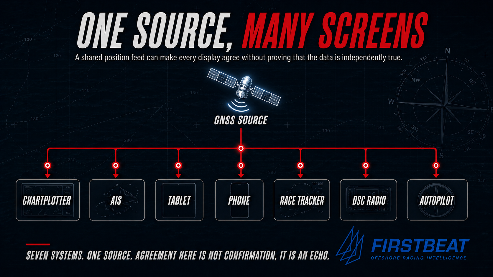
That question matters again, and not because GPS has become useless, because it has not. On most days, in most places, it is brilliant. It matters because GPS, or more properly GNSS, the Global Navigation Satellite Systems including GPS, Galileo, GLONASS and BeiDou, is no longer just a navigation aid. It has become the quiet source of position and time for almost everything on the modern boat. The chartplotter drinks from it, and so do the AIS, the tablet, the phone and the race tracker. The DSC radio may use it, the MOB beacon may use it, the routing laptop may use it, and some autopilot modes may depend on it. The boat can look as if it carries seven independent electronic systems when in truth it carries one position source repeated seven times. That is a very different problem. It is not the failure of one box. It could be the corruption of a whole way of thinking… and all using one power source.
““The boat can look as if it carries seven independent electronic systems, when in truth it carries one position source repeated seven times.””
THE SAME FAILURE, ON LAND
You can watch the same dependence play out on dry land any weekend. Mountain Rescue England and Wales and the Ordnance Survey now run a joint campaign pleading with walkers not to navigate by smartphone alone, because the callouts have a depressingly familiar shape. Cumbria Police have reported people dialling 999 with as little as one per cent of battery left, so the phone dies moments after the call and the very device meant to save them can no longer be used to find them. The Cairngorm team has had walkers spend an entire winter night out with no map and no compass because a phone ran flat. None of those phones lied in the spoofing sense. They simply ran out, lost signal, or ran a free app whose mapping was never good enough for the ground underneath it, and there was nothing behind them. That is the same hole, dug on land.
Afloat it is worse, because position is only the beginning of what depends on the box. A phone makes a perfectly good backup GPS on a boat, provided the right charts are downloaded for offline use, but it is a hungry one, and battery is currency offshore. The free tiers of the popular charting apps will also happily draw your boat sailing across dry land in a narrow channel, which is the same picture the spoofed tankers paint in the Strait of Hormuz, arrived at by accident rather than malice, and a useful reminder that a position is only ever as good as the chart beneath it.
THE BRIDGE AND THE RACE BOAT
My own view of this is shaped by two very different worlds. As a naval officer at Dartmouth I did my naval training, and after my degree in Naval Engineering I specialised as a Weapons Engineer, which in the ships I served in during the 1980s also meant being responsible for the maintenance and running of the mechanical and electronic navigation devices as they then existed and not just the weapons. I did my time as a deck watch officer as well, so I saw navigation from both the bridge and from the machinery and systems side.
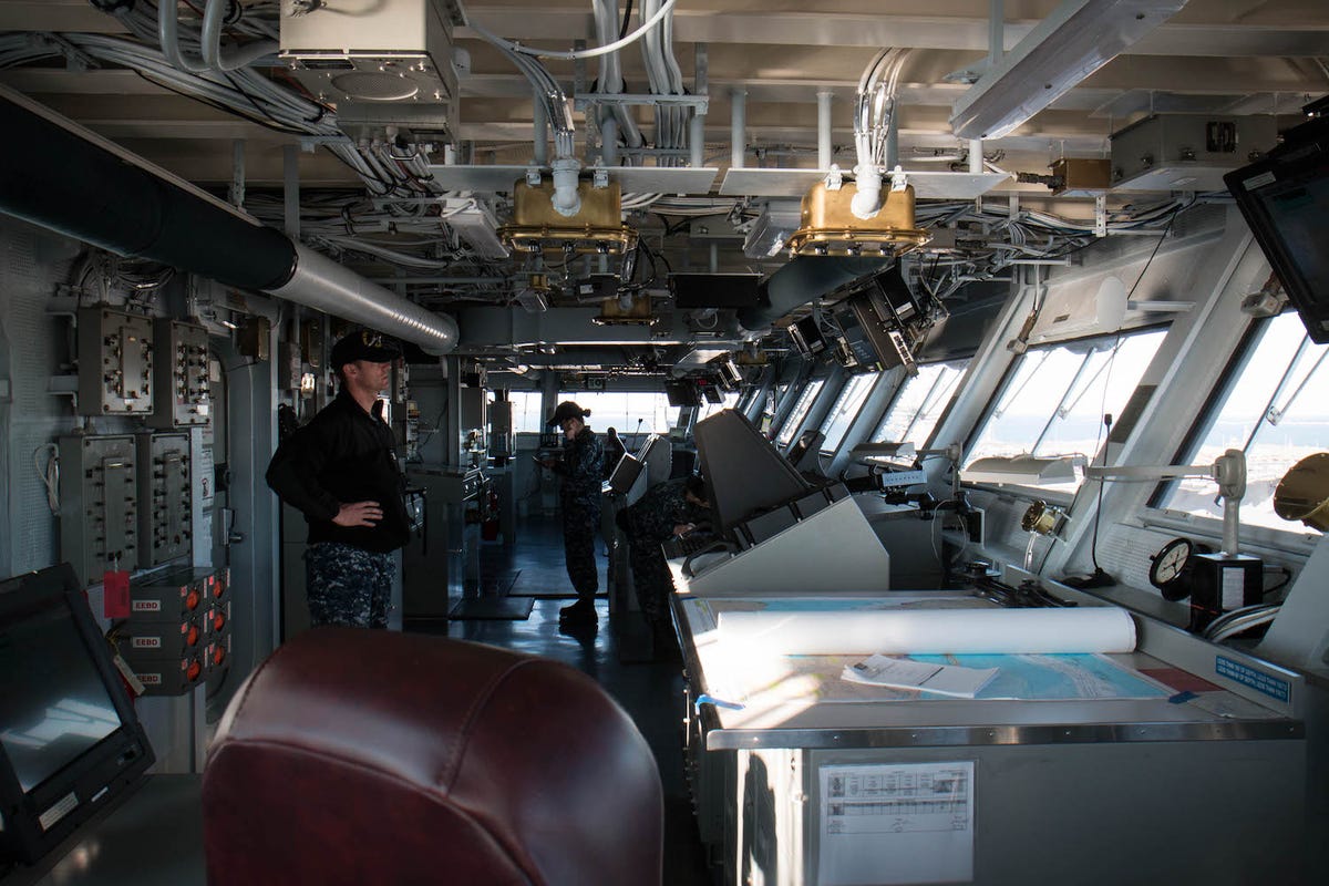
A naval ship had space, order and redundancy. There was a proper chart table, there were books and procedures and trained people, and there were logs, compasses, gyros, radars, chronometers, repeaters, power supplies, backups and people whose job was to keep the whole system honest. The bridge was dry, comparatively steady, properly lit and properly manned, and even when things went wrong the ship was not normally reduced to one small screen and a hopeful glance at the heavens. A racing yacht was another world entirely. My yacht navigation was learned from my father, from racing, from making mistakes, and from wanting to become not just someone who could follow a course but a competent offshore racing navigator. Before affordable yacht GPS, and before small-boat electronic navigation became something you could simply trust, the job was serious in a very physical way. You were often cold, wet, tired and wedged below in a rolling boat with a damp chart, a pencil, a plotter, a compass course, a log reading that might or might not be telling the whole truth, a depth sounder, tidal notes, and a crew who wanted answers. Where are we, how far to go, how long, what is the tide doing, what is the weather doing, and are we going the right way.
On a warship, uncertainty could be absorbed by the system. On a race boat it moved through the crew like cold water. If the navigator sounded hesitant the whole boat felt it, the trimmers felt it, the helm felt it and the owner felt it, and people stopped racing and started worrying. The navigator was not just finding position. He was holding the boat’s confidence together, which is why I have always held that the most important tool of any offshore racing navigator was, and probably still might be, the poker face. You can be wedged below with a damp chart and a fix you only half believe, but the moment that doubt reaches your voice the boat slows down. The plot is private and the confidence is public. That is one of the things modern electronic navigation has hidden from view, because navigation is not just knowing where the boat is, it is maintaining earned confidence in where she is, where she is going, and what you will do when the first answer no longer deserves to be believed.
““The most important tool of any offshore racing navigator was, and probably still might be, his poker face!”
A NEW DILEMMA - ELECTRONIC JAMMING AND SPOOFING
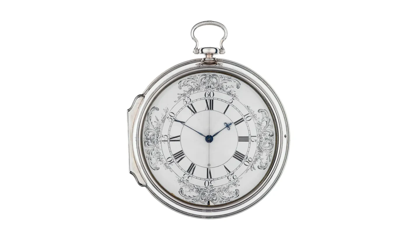
The old longitude problem was about fog, cloud, time and uncertainty. You could not see the sky, you could not trust the clock, and you could not know your east-west position with the accuracy needed to avoid disaster. In 1714 a coalition of merchants and captains pushed Parliament into the Longitude Act and the £20,000 reward it offered, a fortune, for a method that could fix longitude to within half a degree, and John Harrison spent the rest of his life answering it with a machine. The modern version is stranger, because the sky is clear, the screen is bright, the numbers are precise, and the boat may still be wrong. The old fog hid the world from you. The new fog is worse, because it does not hide anything at all. It forges a world and hands it to you with the confidence of a clear day, and that is the part the word does not quite capture, so it is worth holding onto: this is a fog you can see straight through, and it is could still be wrong.
Jamming is the blunt version, in which a jammer simply overwhelms the very weak satellite signal so that the receiver loses lock, the position drops out, the alarms appear, and everyone knows there is a problem. Spoofing is the cleverer and more dangerous version, in which a transmitter broadcasts counterfeit satellite signals plausible enough for the receiver to accept, so that instead of admitting it has no position the receiver hands you a false one, and may hand you false time with it. GNSS spoofing is specifically designed to deceive the receiver into calculating a position, navigation or timing answer that is not true, and that distinction matters offshore, because a dead GPS is merely irritating while a lying GPS is dangerous.
The public examples are no longer theoretical. In the Strait of Hormuz, a passage that carries roughly a fifth of the world’s oil through a gap 21 miles wide at its narrowest, Scientific American reported ships appearing to circle over dry land, cross airports and drift through places they plainly were not, with Todd Humphreys of the University of Texas describing the result on an electronic chart display as “chaos”. Humphreys, who built the first acknowledged civilian GPS spoofer back in 2008, makes the deeper point too, which is that if the ship’s GPS is spoofed its AIS may broadcast that false position to everyone else. That is the step change. A spoofed ship is not merely confused about herself, she becomes a source of confusion to everyone around her. In a narrow commercial choke point that is obvious, and in a yacht race the scale is smaller but the principle is identical: if the truth source is corrupted, all the clever downstream displays become beautiful ways of repeating a lie.
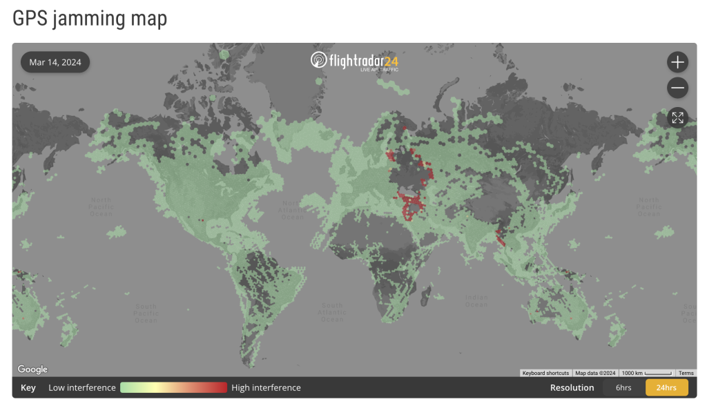
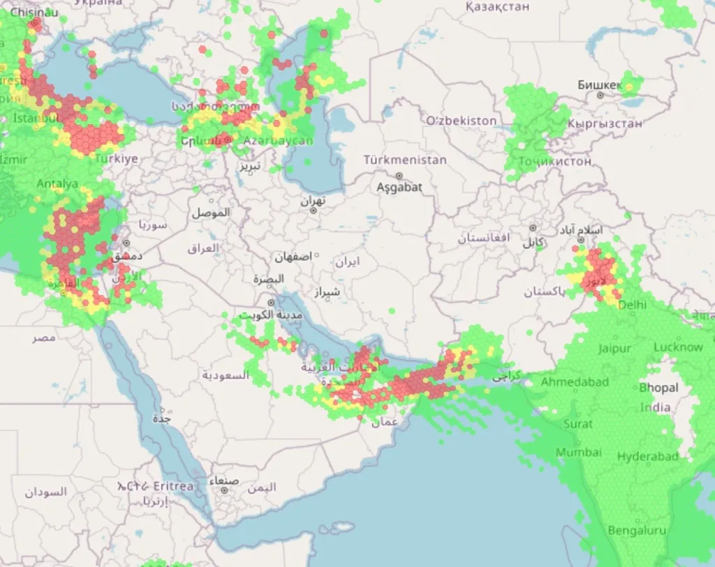
This is not a fringe worry dressed up as a crisis. The Royal Institute of Navigation’s report Impacts of GNSS interference on maritime safety, published in January 2026 and drawn from more than 100 sector experts and 300 vessel captains, logged 20 incidents of physical harm to personnel in interference regions, 19 of property damage and 10 of environmental damage, and more than one in ten respondents said they had been led into an unsafe or unlawful situation. Three quarters said the problem is not improving.
““A dead GPS is irritating. A lying GPS is dangerous.””
THE OFFSHORE PROBLEM
Most offshore sailors do not race through the Strait of Hormuz, and most are not being deliberately targeted by state-level electronic warfare, which is the easy reason to ignore the subject. The harder truth is that spoofing exposes a weakness that already exists on a great many offshore boats, because we have become very good at operating electronic navigation when the system is healthy and much less good at knowing what remains when it is not. A lot of modern race boats no longer have a real chart table at all, just a folding shelf, a laptop, a tablet bracket and a charging lead, and the boat is lighter, wetter, faster and less forgiving for it. Everything is networked, everything is repeated, and everything is clean until it is not. The navigator can now run weather routing, AIS overlays, tidal models, polar percentages, laylines, tracker comparisons, Expedition or Adrena outputs, GRIBs, performance numbers and several screens of tactical information that would have seemed like science fiction to a 1980s yacht navigator, and that is progress. But progress is not the same thing as resilience.
The old yacht navigator was not romantic, he was practical because he had no choice. A sight from the sextant on a small offshore race boat was never as clean as the textbook made it sound, because the boat rolled, the horizon disappeared, the sky closed in, the watch was busy, and there was no yeoman standing by to call the time, so on many races a useful celestial fix was a rare luxury rather than a daily certainty. You used what you had, which meant dead reckoning from a known position, a compass course, log distance, a leeway estimate, the tide, the depth and the soundings, headland and buoy bearings, three-point fixes when you could get them, transits, clearing bearings, radar ranges if fitted, and a feel for whether the plot made sense. Some of those methods would have been frowned upon in a formal naval context if used carelessly, but on a yacht they were sometimes the only available truth, not perfect truth, but independent truth, drawn from the physical world rather than from a distant signal. That is the part we need to recover, not because old navigation was better, because it was often worse, but because it was independent.
THE DANGEROUS WORD: AGREEMENT
One of the most misleading things on a modern boat is agreement. The chartplotter says one thing, the tablet says the same, the phone agrees, the AIS target display agrees and the routing laptop agrees, so it must be right. Not necessarily, because if every one of those systems is ultimately taking its position and time from GNSS, then agreement between them may prove nothing more than that the same bad data has reached every display. That is why the basic navigator’s instinct has to change, so that the question is no longer whether the screens agree but whether any of them are actually independent. A phone is not independent if it is using satellite position, a tablet is not independent if it is using its internal GNSS chip, a second GPS receiver is not truly independent in a spoofing area because it is listening to the same poisoned sky, and a second plotter is often just a second witness repeating the same false evidence.
Independent means something else. It means a magnetic compass, a log and a depth sounder, a radar range and bearing, a paper chart, a hand-bearing compass and a visual transit. It means the contour of the seabed, the loom of a lighthouse and the shape of the land, and it means time kept by a watch that has not asked a satellite for permission to exist. It means something that still works when the network goes quiet or starts lying.
““Agreement between your screens may prove nothing more than that the same bad data has reached every display.””
SAFETY, NOT JUST NAVIGATION
There is another reason this matters. The first reaction to any discussion of GPS failure is usually that you can navigate without it, and many experienced sailors genuinely can. But the modern GNSS problem is not only about the navigator’s position, it is about the other equipment that has quietly become dependent on position and time. AIS needs both, DSC distress calling may include position, MOB devices may use GNSS or AIS, EPIRBs increasingly include GNSS-derived positions, plotters and tablets use GNSS, and some autopilot functions steer to a waypoint, route or ground track derived from satellite position.
A 406 MHz EPIRB is not simply made useless by the loss of GPS, because the Cospas-Sarsat system can detect and locate 406 MHz distress beacons, and modern search-and-rescue satellites can use methods other than a beacon’s own GNSS position to find it. But built-in GNSS gives a much faster and more precise position when it is healthy, while local AIS-style MOB devices are far more directly dependent on the correctness of their position source. So the right conclusion is not that distress systems are hopeless, it is that the skipper needs to know what each one is actually using. Does it transmit a GNSS position, does it still alert without one, does it carry a 121.5 MHz homing signal, does it have AIS, does the crew know what appears on the plotter when an AIS MOB beacon activates, and does anyone know what to do if the displayed MOB position is obviously wrong. The problem is not that modern equipment is bad. The problem is that we often do not understand its dependencies until the moment we need it.
WHAT THE INDUSTRY WILL FIX, SLOWLY
The technical answer is coming, but not evenly and not quickly enough for every yacht. Galileo now carries OSNMA, Open Service Navigation Message Authentication, which lets suitably equipped receivers check that the Galileo navigation message comes from the system itself and has not been modified, and the European GNSS Service Centre declared the OSNMA Initial Service operational on 24 July 2025. That matters because authentication changes the receiver’s relationship with the signal, so that instead of merely hearing a plausible message it can begin to ask whether the message proves where it came from. But it is not a magic shield for every sailor, because the receiver has to support it, the installation has to use it properly, and it helps with spoofing of the navigation message rather than with every form of jamming, denial, antenna failure, poor installation, power loss, network fault or human overtrust.
Other answers are developing alongside it: multi-constellation and multi-frequency receivers, better antennas, inertial systems and terrestrial backups. The UK has just committed £155 million to position, navigation and timing resilience, including £71 million toward a national eLoran system, a high-powered, low-frequency signal from the ground that is inherently far harder to jam or spoof than a faint satellite and accurate to around ten metres. Researchers are even navigating off what one of them calls signals of opportunity, cellular masts and Starlink among them, on the principle that the more sources you listen to, the harder you are to deceive, and Zak Kassas of Ohio State calls it security by diversification. It is the old navigator’s instinct restated in radio frequency, and it is welcome, but none of it removes the skipper’s responsibility. A better receiver is useful. A better habit of mind is essential.
THE FALLBACK ORDER
For most offshore racers and cruisers the answer is not to make celestial navigation the first fallback, because that is another romantic trap. If you are racing in the Channel, around Ireland, across Biscay, around the Fastnet, through the Solent or along a coastline, the immediate independent layers are far more ordinary: the compass, the log, the depth, the tide, the paper chart, the radar, visual bearings, clearing lines, transits, the last known good fix and a running dead reckoning. Celestial navigation belongs in the box, particularly for ocean passages, but it is not the first thing you reach for when the plotter looks odd off Portland Bill. The first thing you reach for is the physical world around the boat. What depth should we have here, what does the compass say, what was our last believable fix, what course have we actually steered, what has the tide done, what does the radar range say, does the coastline fit, are the lights where they should be, and is the buoy where the screen says it is or where the world says it is. That is not nostalgia, that is navigation.
THE SEXTANT STILL HAS A PLACE
The sextant still matters, but it should be put back in its proper place. It is not a magic wand, it is not a substitute for coastal pilotage, and it is not much use if nobody aboard has practised with it since passing an exam years ago. But it remains the only position-fixing instrument on the boat that cannot be jammed, spoofed, hacked, switched off by a satellite outage or corrupted by a network fault, because it transmits nothing and receives nothing artificial, and instead puts a question to the sky, the horizon, your eye and your timekeeper. For ocean sailing that is still powerful, and the modern version need not involve pages of sight reduction table misery. A sextant, an almanac, a calculator, a plotting sheet and someone who has actually practised can produce a perfectly useful independent check, because the whole sight reduction now collapses into two lines a basic scientific calculator handles in seconds, well maybe a bit longer!
“THE TWO FORMULAS Calculated altitude: Hc = sin⁻¹ [ sin(D)·sin(L) + cos(L)·cos(D)·cos(LHA) ] Azimuth: Z = cos⁻¹ [ ( sin(D) − sin(L)·sin(Hc) ) / ( cos(L)·cos(Hc) ) ] D is the body’s declination, L your assumed latitude, LHA the local hour angle. Measure the body’s real altitude Ho with the sextant. The difference between Ho and Hc, in minutes of arc, is your intercept, one minute of arc being one nautical mile, toward the body if Ho is the greater and away if it is less. Cross two such lines and the crossing is your latitude and your longitude. The only electronic thing in your hand is a calculator that listens to no one.”
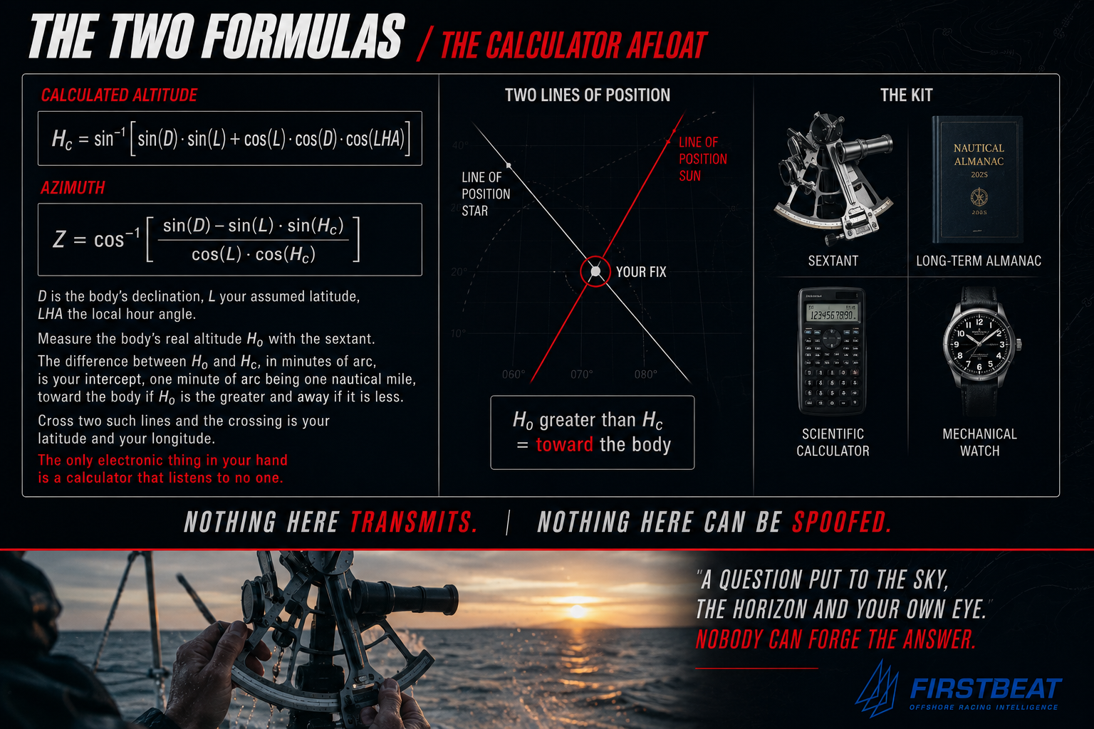
What the calculator cannot give you is the declination and hour angle of the body at the instant of the sight, and the annual Nautical Almanac supplies that on paper. Better still for a self-sufficient boat is Geoffrey Kolbe’s Long Term Almanac 2000 to 2050, a single book of the sun and the navigational stars valid for a generation rather than a year, paired with Mary Blewitt’s Celestial Navigation for Yachtsmen, the slim classic that has taught more cruisers astro than any other book. None of this will give you the precision of GPS, and it does not need to, because its value is not centimetric accuracy but the fact that it belongs to a completely different family of truth. That is what resilience means in the end, not one perfect answer but several imperfect answers whose errors are unlikely to be the same.
““Resilience is not one perfect answer. It is several imperfect answers whose errors are unlikely to be the same.””
THE WATCH QUESTION
Every celestial fix depends on time, and if you get the time wrong your longitude walks away, because four seconds of time is roughly one nautical mile of longitude at the equator, reducing with latitude. The sextant is only half the system, the other half is the timekeeper, and this is where the old chronometer habit still matters. Not necessarily the box chronometer of the naval bridge, but the principle behind it, which is to know the rate, (the number of seconds it is wrong every day)
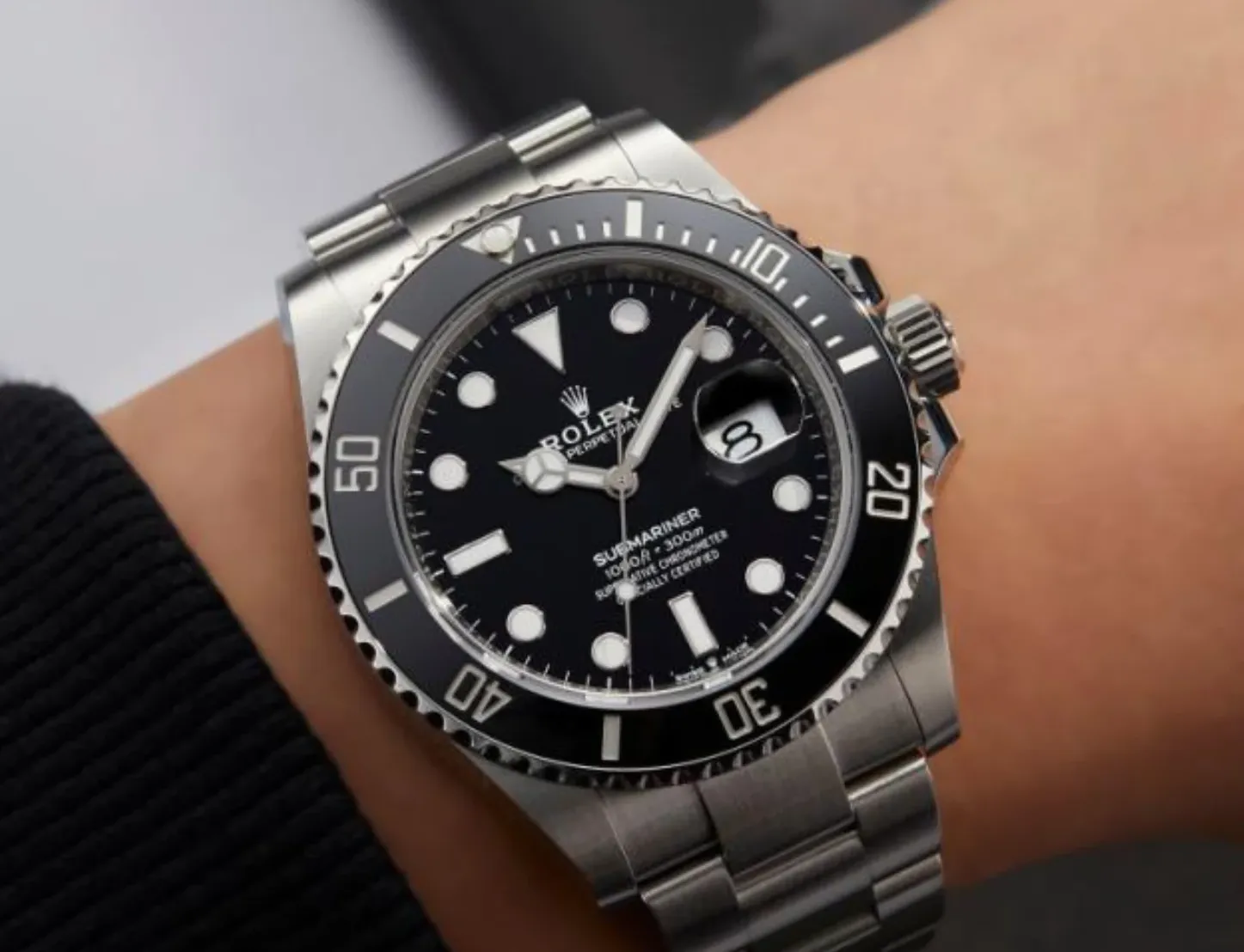
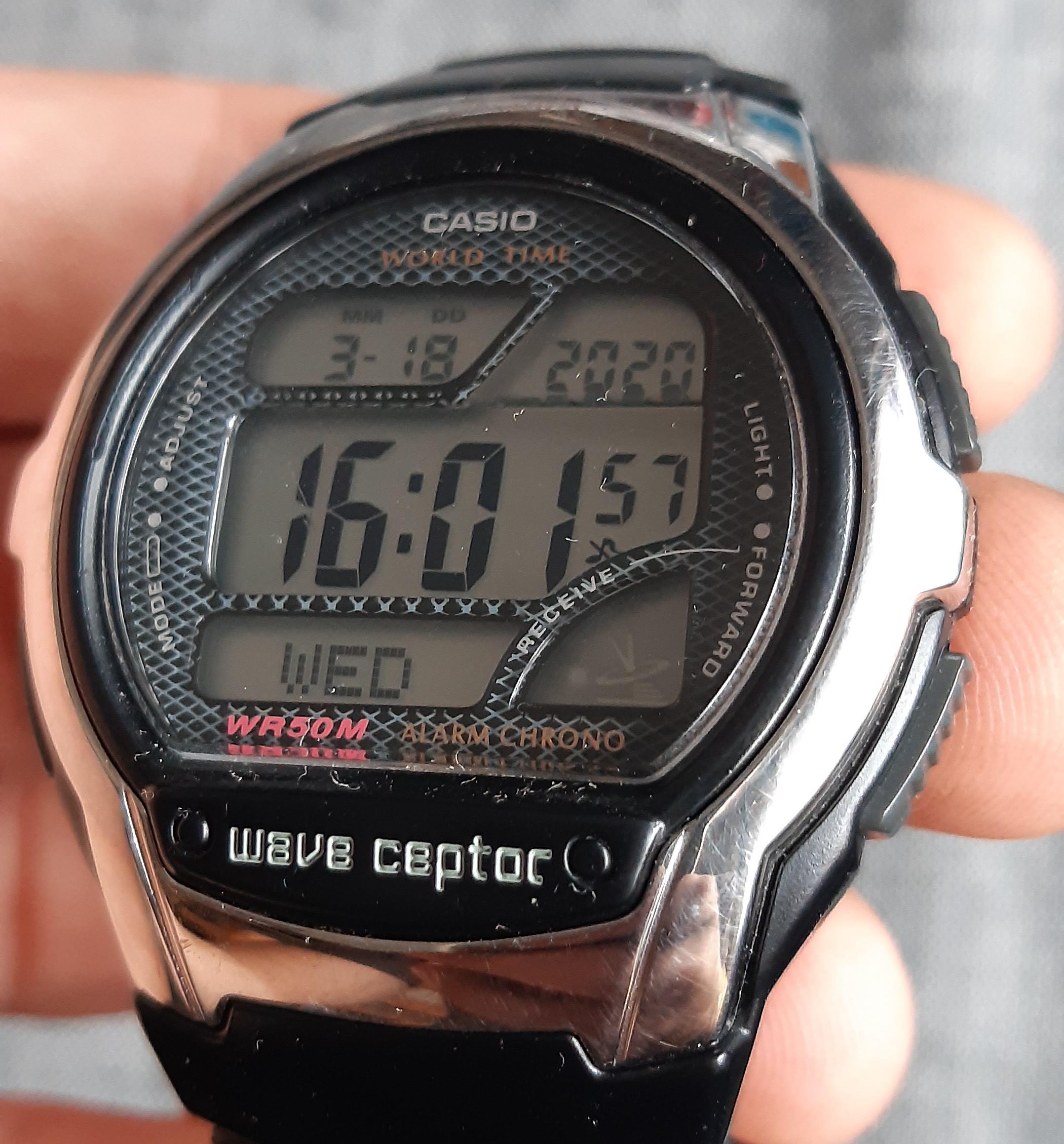
A GPS watch is wonderfully convenient right up until the thing you are worried about is GNSS corruption, at which point it fails in precisely the conditions you bought it for. A radio-controlled watch is useful near the right shore stations, but it is still dependent on a broadcast, and there are only a handful of those stations on Earth, none of them reaching mid-ocean. A smartwatch leans on its own ecosystem of phone, network and satellite assumptions. For a small boat the practical answer is simple. Carry two independent quartz watches that do not set themselves by GPS, phone or radio, set them before departure against a reliable source, note their error, check their rate, keep one in the grab bag or nav dry box, and carry spare batteries. A good mechanical watch can be a useful third layer, especially if its rate is known, and a COSC-certified mechanical chronometer is tested to a daily rate between minus four and plus six seconds per day. But the important point is not perfection, it is regularity, because a watch that gains steadily can be corrected while a watch whose behaviour you do not know is just another opinion. Again this is not romance, it is the old navigator’s discipline translated into modern amateur terms: do not worship the instrument, rate it, question it and cross-check it.
THE “GNSS SUSPECT” ROUTINE
Every offshore boat should have a simple routine for the moment GNSS becomes suspect, not a twenty-page manual and not a committee meeting, just a routine.
The first step is to stop trusting agreement between the screens, because if the plotter, phone, tablet and laptop all use GNSS they are not four fixes, they are one fix repeated.
The second is to mark the last believable position, with its time, log, course, depth and conditions, because that becomes the start of the recovery.
The third is to start or restart a proper dead reckoning, with course steered, speed through the water, leeway estimate and tide, updated at sensible intervals.
The fourth is to shift the autopilot into a mode that does not depend on the suspect data, which means knowing in advance whether you are steering to compass, wind, waypoint, route or course over ground, because those are not the same failure case.
The fifth is to use the physical world, the radar ranges, visual bearings, depth contours, transits, clearing bearings, lights, soundings and land shape, and the buoyage, with appropriate caution.
The sixth is to isolate the bad data if the system allows it, because some instrument networks let you select, deselect or prioritise GNSS sources and some do not, and the skipper and navigator should know which before the race rather than during the failure.
The seventh is to tell the crew calmly what is happening, because confidence matters, and the message is not that we are lost but that the satellite position is suspect, so we are navigating from dead reckoning, compass, depth and radar until it proves itself again. That sentence alone can change the mood of a boat.
WHAT TO CARRY
The resilient amateur offshore boat does not need to become a museum. It needs a few independent basics that are maintained, accessible and practised:
• A paper chart for the sailing area, not buried under wet kit.
• A plotting tool, pencil and rubber.
• A hand-bearing compass, and a known-good steering compass with a written note of deviation if known.
• A working log and depth sounder.
• A simple tidal reference, and a way to take and plot bearings.
• Radar, if fitted, practised as a navigation tool rather than just a collision-avoidance screen.
• Two independent non-GNSS timekeepers.
• For longer offshore and ocean passages, a sextant, an almanac or long-term almanac, a calculator, plotting sheets and someone aboard who can actually use them.
Most important of all is a culture in which the navigator keeps a rough dead reckoning alive before the panic begins, because a DR started after the electronics fail is already late.
THE NAVIGATOR’S REAL JOB
Offshore navigation has always had a psychological component. On a race boat the navigator is not simply the person below with the screen, but part tactician, part meteorologist, part systems engineer, part pilotage officer and part calming influence. The crew may not understand the routing model, the tide gate or why the boat is being taken offshore when the mark is over there, but they absolutely understand uncertainty in the navigator’s voice. That was true before GPS and it is true now. The difference is that today the navigator can sound extremely certain because the screen looks extremely certain, with its decimals, its sharp boat icon, its clean layline, its authoritative ETA, its tracker confirming the fleet and its routing software making the decision look mathematical. But certainty is not the same as truth. The best modern navigator is not the one who rejects electronics, which would be absurd, but the one who uses them hard while always knowing what they depend on, who keeps asking where this position comes from, where this time comes from, what happens if the GNSS feed disappears, what happens if it is wrong, and what can still be proven without it. That is the difference between screen operation and navigation.
NOT ANTI-GPS. ANTI SINGLE-SOURCE THINKING.
This is not an argument against GPS, which has saved more yachts from bad navigation than any other invention I can think of, and has made landfalls safer, pilotage easier, racing smarter, weather routing better and small-boat seamanship more accessible. But we have let it become too central and too invisible. The risk is not that every amateur offshore boat is about to be spoofed tomorrow, it is that we have built boats and habits that assume the satellite answer is the first truth, the second truth and the final truth, so that we have confused repetition with confirmation and mistaken convenience for resilience. The old navigators were not better because they were old, they were better at one thing because they had to be, in that they expected uncertainty. They knew that position was an argument, not a decree: the compass argued with the tide, the log with the leeway, the depth with the chart, the bearing with the dead reckoning and the sky with the clock, and the navigator’s job was to listen to the arguments and decide what was most likely true. That habit needs to come back, not instead of modern navigation but alongside it.
THE SEA HAS NOT CHANGED
The sea has not changed. The rocks are still hard, the tide still runs, the fog still comes down, the crew still want to know where they are, and the owner still looks at the navigator when the boat is slow, late, lost, cold, overpressed, underpowered, becalmed or going the wrong way. Only the fog has changed, and some of it is still made of water while some of it is now electronic. The cure is much the same as it always was: do not depend on one source of truth, do not believe an instrument simply because it speaks with confidence, and never let the boat reach the point where the failure of one system leaves you with no idea what to do.
*End*


Comments