
How I set up race instruments for offshore racing (properly)

Most offshore race boats are not slow because of bad sailing. They are slow because they are looking at the wrong numbers. And the worst part? Most crews never realise it.
There is a moment, early in any race-boat coaching engagement, when I know whether I am in for a quick conversation or a long afternoon.
It happens when I step onto the boat for the first time.
I am not looking at the instruments, not yet. I am watching how the crew relate to them. Are their eyes drawn immediately to the displays like the way some people compulsively check their phones? Or are they scanning the boat, the horizon, the trim, using the instruments as one input among many?
That instinct tells me a great deal about how information is being used on board. And after many years coaching offshore racing boats, from club-level campaigns to serious offshore programmes, I have come to believe that most boats are not slow because of bad sailing. They are slow because they are often looking at the wrong numbers. Or worse, at too many numbers. Or worst of all, at numbers they have never actually verified are correct.
What follows is not a complete offshore racing instruments manual. It is one part of what I do when I first step aboard as a coach. But it is a foundational part,because if the information on board is not clear, consistent, and trustworthy, then every tactical decision, every trim change, every steering input is compromised from the very start.
1. BEFORE I LOOK AT AN INSTRUMENT
When I first step onto a race boat, I run a quick mental check that begins not with technology but with fundamentals.
Is the log clean and properly aligned? Is it actually reading water passing beneath the hull, or is it fouled, offset, or partially obstructed? Are the seacocks where they should be? What are the batteries doing — are we comfortably above 12 volts, ideally in the 12.8 to 13.5 range that indicates a healthy charge state? How many phones are plugged into USB sockets, quietly draining the system while the crew are below?
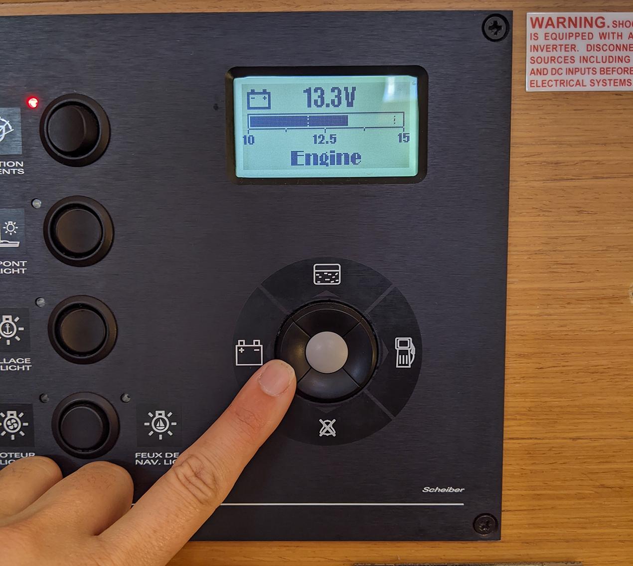
The domestic and engine-start batteries — are they properly isolated? I have seen races compromised, and one delivery turn frightening, because someone had discharged everything into a shared bank and the engine refused to start when conditions demanded it.
Then visibility. Are the instruments set to maximum brightness for daylight? Does every crew member know how to switch to night mode — and not just a dimmed version, but proper red-screen mode that protects night vision? Do the autopilot remotes work? Are they charged?
I have seen entire instrument systems rendered effectively useless by a flat battery in a wireless remote. It sounds almost embarrassing to mention. But it happens, consistently, on boats that would describe themselves as serious racing campaigns.
Then the crew. Do they all have torches? Do those torches have both red and white modes, and do they understand when to use each? Red light preserves the rhodopsin in the eye — the photopigment responsible for night vision — and a crew that has protected theirs will be faster, calmer, and safer than one that has been blasted with white light every time someone checks the chart table. Offshore performance at night is as much about preserving physical capability as it is about skill and strategy.
All of this happens quickly, and in parallel. I am also clocking the engine, the sails, the safety gear, the food and water, the general organisation of the boat. Offshore preparation is holistic. You cannot compartmentalise one system while ignoring the rest. But once I am satisfied the boat is fundamentally sound, I turn to the part most crews think they have already got right.
The instruments. And that is where the real work usually begins.
2. THE PLOTTER — CLARITY OVER HISTORY
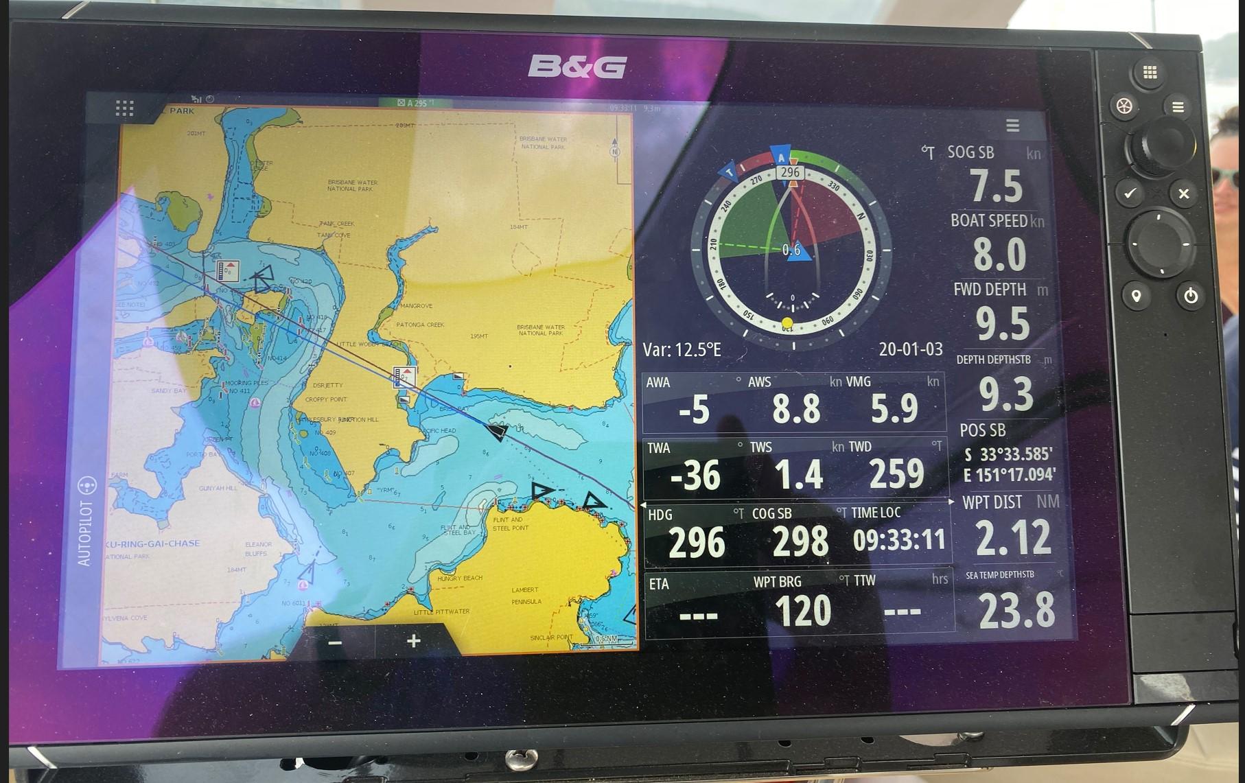
The first place I look is the plotter. And more often than not, it is full.
Old routes. Old tracks. Waypoints from deliveries, from races years ago, from half-formed plans that never became anything. It is not navigation. It is accumulation.
The problem is not simply untidiness, though there is a genuine psychological argument for a clean workspace. The real problem is cognitive load. When a display is cluttered with irrelevant information, the brain must work harder to find the signal in the noise. Research drawn from aviation an environment that shares much of offshore sailing’s mix of fatigue, time pressure, and high-stakes decision-making has consistently found that increasing the volume of available information does not improve decision quality. Often it degrades it, because the mental effort required to filter irrelevant data consumes capacity that should be available for action. Offshore, especially at night or in deteriorating conditions, that cognitive bandwidth is not a renewable resource.
So the first job with the plotter is simple: delete.
Not refine. Not archive. Not tidy up and come back to. Delete. Keep only the trusted waypoints, the essential marks, the current race information. Everything else is noise. And offshore, clarity beats history every single time.

3. THREE NUMBERS ON THE MAST
The mast is where performance actually happens. It is the interface between the boat and the people sailing it, the data visible to the helm and the trimmers in real time, in all conditions, often in spray, in failing light, in the middle of a cold watch at 0200.
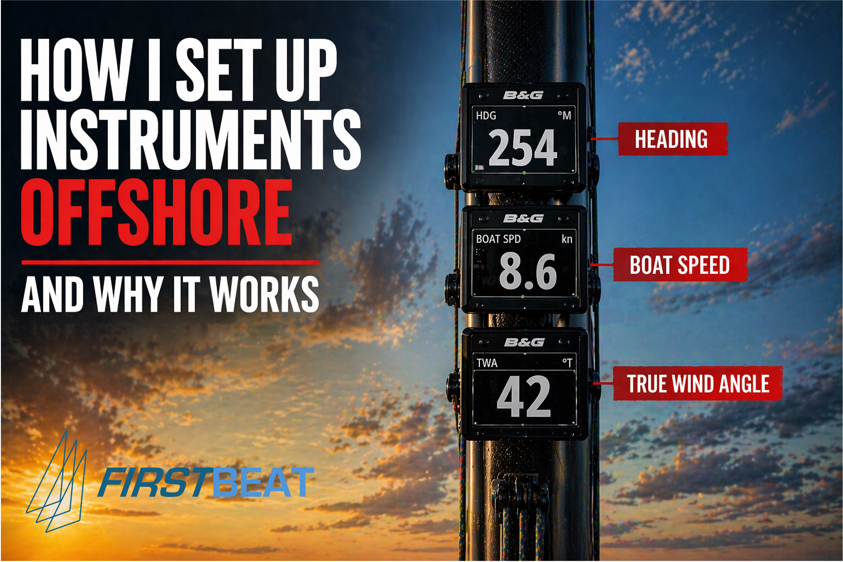
What I am looking for when I examine a mast display is simple: three numbers. Heading. Boat (speed through water). True wind angle. Those three numbers govern direction, efficiency, and the boat’s relationship to the wind. Everything else, sea temperature, ambient barometric pressure etc, is at best secondary, and often actively irrelevant. Yes you could have more displays and the new screens which you can show anything the system can generate but my experience shows that for the best focus make sure the BIG three stand proud.
If those three numbers are not immediately legible, clear, large enough to read at a glance from the wheel, in a font that does not require squinting in spray — we fix that before anything else. And here is the thing that consistently surprises people: if there is more data on the mast than those three numbers, I do not automatically add to it. Often, I remove them or make them smaller than the big three.
Because if you need to read it twice, it should not be on the mast.
This is not a rejection of data or modern instrumentation. Systems from B&G, Raymarine, and Garmin are remarkable tools, and the information available through a fully integrated setup is genuinely extraordinary. But the mast is not the place for a dashboard. It is the place for the three numbers that need to live in the helm’s peripheral vision at all times. Everything else belongs below, or at the nav station, where it can be consulted deliberately rather than passively absorbed or worse, passively ignored.
A note on helming:
The word helm comes from the Old English helma — meaning tiller, the physical lever slotted onto the rudder post, the point where human intention meets the mechanism that moves the boat. To be at the helm is not a figure of speech. It is a precise description of where you are and what you are doing.
Which is why the word “driving” grates. You drive a car because you are managing an engine and a mechanical linkage to a road surface — you supply the power and the direction, and the machine obeys. On a boat, the helmsman is doing something fundamentally different: reading the wind, the sea state, the sails, the heel, the feel transmitted through the helm, and constantly negotiating between all of them. The rudder is not primarily a direction device. It is a drag device, and overusing it costs speed. A good helmsman steers as little as possible, not as much as possible.
Driving implies dominance over a machine. Helming implies a conversation with the sea. That distinction is not pedantry — it reflects a completely different understanding of what is actually happening beneath your hands.
It also reflects the level of concentration the helm demands. When you are on the helm, that is your job. You cannot helm effectively and simultaneously manage the deck, call tactics, navigate, and make crew decisions. The best sailors understand this instinctively — they delegate everything else while they are on the helm and give it their full attention. (Single and double-handed sailing operates differently, and I will address that in a separate piece.)
This brings me to a training concept I return to constantly, which I call the Three S’s: Sea, Sails, and Speed.
The idea is deliberately simple, and that is precisely its value. The best helmsmen I have worked with do not scatter their attention across a cockpit full of instruments and competing demands. They cycle through three focal points, in order, and repeat.

Sea first. Look at where the boat is going. Judge the movement of the bow relative to the water ahead — or to the clouds, the land, the horizon. This is where you feel how much helm you are actually applying, whether the boat is working with the sea or fighting it, and where the next wave or gust is coming from. The sea is always the primary reference.
Sails second. Look at the luff of the headsail or the spinnaker. Is the flow correct? Does it correspond with the heel angle and the current trim? The sails tell you whether the boat is properly powered, overpowered, or starved — and that information should be read in the context of what you just observed from the sea.
Speed third. If you know your target speed — and you should, because you have learned it from your polars — the number on the mast tells you immediately whether the boat is where it needs to be. Because boat speed sits alongside TWA on the mast display, your eye takes in both in a single glance. If the speed is correct, the true wind angle will be correct. The numbers make sense together, or they tell you something is wrong.
If a course is being sailed rather than a pure wind angle, the VMC will be set by the tactician or navigator — a brief glance at the mast instruments is all that is needed to confirm alignment. Then back to sea, sails, speed. That is the cycle.
It sounds almost too simple. But in my experience, simplicity is exactly what the helm demands. The boat will sail better for it. It nearly always does.

4. THE TRUE WIND QUESTION
This is where many boats quietly lose miles, race after race, without ever identifying why.
Apparent wind is what your sails actually feel, the combination of the true environmental wind and the artificial headwind created by the boat’s own forward motion. It is what your masthead sensor measures. It is real, in the sense that it is the wind your rig is responding to in any given moment. But it is reactive. As the boat accelerates, apparent wind clocks forward. As the boat slows, it opens. In a seaway, particularly downwind, with waves pushing the stern and the boat surging and checking, apparent wind can shift and oscillate in ways that are deeply unhelpful as a primary steering reference.
True wind is the actual wind blowing across the water, independent of the boat’s speed and direction. And critically, it is the reference system that polar diagrams are written in. The performance targets that define what your boat should be doing at any given wind angle and wind speed, the numbers that tell you whether you are performing or just moving, are built around true wind angle and true wind speed.
My preference offshore is to steer to True Wind Angle . It provides a more stable reference, particularly downwind and in confused sea states. It aligns directly with the performance benchmarks we are working towards. And when a boat is surfing down a wave and accelerating, precisely the moment when apparent wind is at its most misleading, true wind angle holds steady and keeps the helm on course rather than triggering an overcorrection.
There is a caveat, and it matters. True wind is not measured. It is calculated. The instrument system takes apparent wind angle, apparent wind speed, boat speed, and heading, then derives true wind from those inputs using vector mathematics. Which means that if any of those source values are wrong, and they frequently are, the true wind angle your display shows you is wrong. And if your true wind angle is wrong, your polars are worthless.
The rule, then: a well-calibrated, verified instrument system justifies steering to true wind angle. A system with unknown or doubtful calibration means trusting feel, trusting boatspeed, and keeping apparent wind always available as a cross-check. Never navigate blind on a derived number you cannot validate.

5. TRUE OR MAGNETIC? THE CONSISTENCY RULE
This question is not, at its heart, a theoretical debate. It is a communication question.
My preference is magnetic heading displayed at the mast, the helm’s primary reference, with true heading used within the navigation systems. Magnetic compass bearings are what we navigate by in practice, what we communicate by on the VHF, and what most crew have been trained to work with since their first sailing course. True heading has its place in passage planning, in integrating with chart plotters, and in interpreting synoptic weather information. But it is a conversion step away from immediate practical use.
Note:

In European waters today, magnetic variation is less than a degree — and that near-irrelevance has quietly allowed an entire generation of skippers to forget, or never fully understand, how catastrophically it can affect navigation when it matters.
Magnetic north is not fixed. It wanders continuously, driven by the slow movement of the Earth’s magnetic core, and the rate and direction of that drift changes over time. When I began sailing, the variation in the English Channel was somewhere between seven and eight degrees west — meaning that a compass bearing and a true bearing of the same heading differed by that amount. On a paper chart, with parallel rules and a pencil, that difference had to be applied correctly every single time you laid off a course. Get it wrong and you were not navigating. You were guessing with false precision.
The mnemonic we used was compass to true, add east — meaning that to convert a compass bearing to a true bearing, you added the easterly variation, or subtracted the westerly. The reverse, true to compass, subtract east , worked in the other direction. In practice, with westerly variation dominant in northern European waters, the arithmetic meant subtracting when laying off from chart to compass, and adding when transferring a compass bearing back to the chart. It was a discipline, and it was taught carefully, because the consequences of reversing it were not theoretical.
Consider a Channel crossing. If your course is seven degrees in error, one full compass rose graduation, and you sail for ten hours at six knots, you will cover sixty nautical miles. The cross-track error, calculated formally as distance multiplied by the sine of the angle, is 60 × sin(7°) = 7.3 nautical miles . A useful rule of thumb gives you the same answer more quickly: the 1 in 60 rule states that for every 60 miles sailed, one degree of error produces one mile of lateral displacement. Seven degrees over sixty miles gives seven miles. Either way, you are more than seven nautical miles from where you believe yourself to be.
Seven miles is the difference between winning and losing a race. In the wrong conditions, off a coast like Selsey Bill, it is the difference between a safe passage and putting the boat aground.
The current near-zero variation in European waters does not make this history. The magnetic pole continues to move. Variation will increase again in British and European waters over the coming decades, as it has many times before. And the habits of thought that come from understanding variation, checking it, applying it, never assuming it is negligible, are the habits of a navigator rather than someone who follows a line on a screen and hopes for the best.
What matters more than which system you choose is consistency. Everyone on board must be working within the same reference framework, and must know they are doing so.
Small discrepancies between a compass bearing and a chart plotter — one reading true, one reading magnetic, the difference unrecognised — become navigational errors offshore. The magnetic variation in UK and northern European waters is typically one to three degrees west. In a marina, this is ignorable. On a long offshore leg, approaching a tidal gate or entering a harbour in the dark, it is not. And at a race mark, rounding on the wrong side of it, it is expensive in a different way entirely.

6. TESTING BEFORE THE START
As we head out towards the start area, we test. Not passively observe — actively test.
Port tack. Starboard tack. In reasonably consistent conditions, the true wind angle shown on each tack should balance — not identically, but within a few degrees of symmetry around the wind direction. If we are showing 42 degrees on port and 52 degrees on starboard, something is wrong: in the sensor alignment, in the wind transducer calibration, in the heading reference. We note it. We work around it. We do not pretend it is not there, which is the most common response and the most damaging one.
Then boatspeed. We compare the log — the paddlewheel or impeller measuring water passing beneath the hull — against GPS speed over ground. In negligible tidal current and calm conditions, these should correspond closely. They almost never do. The log reads high. Often meaningfully so.
This matters for one precise reason: polar targets are the benchmarks against which you measure performance. If your boatspeed is reading two or three percent above reality, you will appear to be hitting your targets when you are not. You will look fast when you are actually average. The feedback loop that drives improvement — notice underperformance, identify cause, correct it — is broken before the race has even started.
In practice, experienced offshore navigators expect real-world polar performance of somewhere between 90 and 98 percent of theoretical targets in typical racing conditions. Reading 100 percent consistently, or over, is a calibration problem. Not a performance achievement.

7. THE AUTOPILOT PROBLEM
I check the autopilot next, and this is where I often find the most significant, and least acknowledged, source of lost miles in offshore racing.
Upwind, most autopilots behave adequately. The course is relatively stable, the steering inputs are modest, and the consequences of a degree or two of wander are manageable. Downwind is where it matters and where the physics of autopilot behaviour can work actively against you.
Here is the mechanism. An autopilot steering to apparent wind angle will, in any meaningful seaway, misinterpret wave-induced acceleration as a wind shift. The boat surfs down a wave and accelerates. As speed increases, the apparent wind clocks forward, towards the bow. The system detects what it reads as a windward shift and bears the boat away to compensate. This is precisely the wrong input at precisely the wrong moment. It induces oscillation. In worse cases, it leads to accidental gybes, broaches, torn sails, and a crew situation in the middle of a black night that nobody needs.
Switch the autopilot to true wind angle mode downwind, and it steers to a reference that does not react to wave-induced speed variations. The boat can accelerate down a wave naturally. The pilot holds course. The miles sailed over a 24-hour offshore passage in that mode compared to apparent wind angle mode can be substantial.
Beyond mode selection, there is the question of tuning. Gain settings, response time, and damping parameters that produce smooth steering in calm water may be entirely wrong in a seaway. A pilot wandering 15 or 20 degrees either side of its target heading on a downwind leg in two metres of swell is not helping the boat, it is costing it distance actively. And the honest conclusion in those conditions, not the comfortable one, but the honest one, is that a rested human helm will be faster. The crew should know how to make that call, and make it without hesitation.

8. THE PLOTTER THROUGH THE RACE
The plotter’s role changes as a race develops, and the mistake most boats make is treating it as a static tool, the same setup, the same brightness, the same information density from the start gun to the finish.
Before the start, the plotter is a tactical instrument: line bias, approach timing, laylines to the first mark. At this stage I want it purposeful and uncluttered, nothing on screen that is not relevant to the next twenty minutes.
During the passage, it becomes a navigational and strategic tool: route context, approaching weather systems if we are doing any active routing, AIS for traffic management. It earns its complexity here, and the navigator should be comfortable working with it at depth.
At night, it should be simplified again. Minimum brightness consistent with visibility. Minimal information on screen. The temptation to run the same bright, information-rich display through the dark hours is genuine, it feels more in control, more professional. But the visual intrusion into night-adapted eyes is a real performance cost, and the cognitive demands of a cluttered screen on a tired crew at 0300 are every bit as damaging to boat speed as poor upwind trim or a badly set spinnaker.

9. DATA AS INTERPRETATION, NOT TRUTH
Every instrument system, however sophisticated, follows the same chain: sensor, calibration, computation, display. Wind is distorted by the rigging and sails before it ever reaches the transducer. True wind is derived by vector arithmetic from inputs that are themselves estimates. Targets are modelled on polar data that represents an idealised version of your boat in standardised conditions.
None of this is reality. It is a model of reality. An interpretation. The number on the display is the output of a chain of measurement, assumption, and computation — and error accumulates at every link in that chain.
The America’s Cup programmes, the IMOCA ocean racers, the offshore grand prix boats — they carry extraordinary sensor arrays. The Oracle AC72 that raced in San Francisco in 2013 ran over a thousand data channels. The teams using that data most effectively were not the ones with the most of it. They were the ones with the clearest frameworks for interpreting it, the fastest processes for acting on it, and the discipline to know when to trust the number and when to trust the sailor’s hands instead.
At club offshore level, the principle is identical. The sailor who understands that their true wind angle is a calculated estimate, dependent on calibration quality at every step of the chain, will use it better than the sailor who treats it as ground truth. Healthy scepticism and active calibration are not signs of distrust in the equipment. They are signs of understanding it properly.

10. WHAT THE FASTEST BOATS ACTUALLY HAVE
After many offshore races, crewed and short-handed, in benign conditions and in weather I would prefer not to repeat, I have arrived at a conclusion that is simpler than most people expect.
The fastest boats are not the ones with the most data. They are the ones where the right data is visible, the system is internally consistent, the crew trusts it, and decisions are made quickly and confidently as a result.
That last element matters more than it is generally acknowledged. Speed offshore is not purely a function of trim, angle, and polar targets. It is a function of decision quality. And decision quality degrades when information is uncertain, overloaded, or contradictory. A crew that trusts their instruments makes calls. A crew that does not either hesitates, spending precious seconds on a doubt that should have been designed out of the system beforehand, or stops looking at the instruments altogether and sails on feel alone, which is a different kind of failure and an expensive one.
In most cases, within twenty minutes of stepping onto a boat, I can tell whether it is set up to perform or merely set up to look like it should. The instruments are a large part of that judgment, not because data is everything, but because clarity, consistency, and crew confidence are the invisible infrastructure on which every other element of offshore performance is built.
Get the information right, and everything else becomes possible. Get it wrong, or leave it unverified, as most boats do and you are fighting the race with one hand tied behind your back. You may still finish. But you will never quite know how much faster you could have been.
Note:

System Failure, Human Failure: When the Fundamentals Get Left Behind
I was trained as a navigator at Dartmouth, and the Royal Navy’s approach was unambiguous: you learn the fundamentals before you touch the equipment. Dead reckoning, working your position from a known point using course, speed, leeway, and elapsed time, was the foundation. Depth, tidal streams, weather, and a working knowledge of the coastline were the tools you layered onto it. A log and an echo sounder made the job considerably easier and more precise, but they were confirmations of a picture you had already built in your head. That is how I learned offshore navigation, and it is a discipline I have never lost confidence in.
I mention this not to be nostalgic but because the fragility of modern integrated instrument systems is something every offshore crew needs to understand before it becomes an emergency.
The masthead unit on a racing yacht carries the wind transducer, the instrument that feeds apparent wind angle and apparent wind speed to every display, every calculation, and every performance target on board. If it fails, or if the signal is lost, the cascade effect through the system can be immediate and wide. Most offshore racing boats run an NMEA 2000 network, a digital backbone designed, in principle, to allow individual devices to fail without taking down the others. In practice, the network is only as reliable as its power supply, and NMEA 2000 devices are sensitive to voltage. They are specified to operate between nine and sixteen volts, but data errors begin to appear when supply voltage drops by more than 1.5 volts from nominal. If your batteries are not delivering a clean twelve volts, and offshore after a long night with autopilot, instruments, and navigation lights all drawing from the same bank that is not guaranteed, devices do not simply degrade gracefully. They shut down, power cycle, and output invalid data. The entire information picture on board can disappear at once.
At that point, a handheld GPS will give you latitude and longitude. A phone with charts downloaded locally before departure will give you a useable position. But if you do not have a physical chart on board, you may have coordinates and no means of contextualising them, data without understanding. You know where you are in numbers. You do not know where you are in relation to the reef two miles ahead.
There is a case study from professional offshore racing that illustrates this with uncomfortable precision. On the night of 29 November 2014, during Leg 2 of the Volvo Ocean Race from Cape Town to Abu Dhabi, Team Vestas Wind, one of the most technically advanced racing yachts in the world, crewed by some of the most experienced offshore sailors afloat, ran hard aground on the Cargados Carajos Shoals in the Indian Ocean. The navigator had gone off watch and was asleep. The crew on deck had the chart displayed on screen. The problem was the zoom level. At the scale being used, the shoals appeared as a blue shaded area with spot depths of between twenty and eighty metres. The navigator had assessed the planned track as safe, believing the least depth to be forty metres. Only when you zoomed in sufficiently did the chart reveal that the shoals contained low-lying islands surrounded by drying reef. The official investigation, led by retired Rear Admiral Chris Oxenbould and navigation expert Stan Honey, concluded that the electronic chart system had failed to represent the hazard correctly across several common zoom levels, and that the triggers available to the crew had been overlooked during passage planning.
The Volvo Ocean Race subsequently required all teams to carry paper charts. Not as a gesture to tradition. As a recognition that a physical chart, properly studied, does not depend on a zoom level to show you what is there.
If your VHF radio is still working when everything else has failed, there is a final recourse worth knowing. The Coastguard receiving stations on the south coast of England sit on elevated ground, and their range is considerable. It is entirely possible to raise Solent Coastguard from mid-Channel, and in the right conditions from further south than that. They may be able to provide a D/F fix or direct you towards a safe course. But that course is only useful if you have a compass you can trust, one that has been swung and corrected, with its deviation card to hand. Which brings us back, as everything eventually does, to the fundamentals.
As a coach, my personal backup for this scenario is a Sailproof ruggedised tablet, fully loaded with charts, routing software, and the tools I rely on most. I carry enough battery capacity to run it for the duration of the race plus a reserve margin beyond that. On the majority of modern racing yachts, which carry their own WiFi network, the Sailproof connects directly to the NMEA 2000 bus and gives me independent access to all the boat’s data. If the main system fails, I have a standalone capability ready immediately, charts, position, instruments, and the ability to navigate without touching a single piece of the yacht’s own electronics.
It is not a complicated setup. But it represents a philosophy that every offshore crew should share: understand the technology deeply enough to know exactly how it can fail, and make sure that when it does, you are not starting from nothing.


Comments